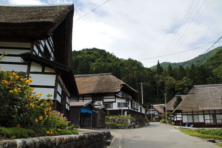
Maezawa L-shaped Farmhouses
The deep snows of the Aizu region meant that, in the past, cut off from other areas for months at a time, its residents had to use all their wits just to make it through the winters. These L-shaped farmhouses known as "magariya" conceal a number of the innovations developed by this local people.As you can see in the layout of the house, the long earth floor stretches out towards the road. Long ago, horses were indispensable in farming, but the deep snow of winter meant that keeping them tied up in external stables was cruel. Therefore, stables were built into the house, meaning that the unfloored working area inevitably became larger. Having this area far from the road made getting to the road through the snow more difficult, as up to a meter can fall overnight. Accordingly, with the aim of reducing work, locating this working area as close as feasible to the road ended up with the house being laid out in an L-shape.Many of these houses were built in Maezawa and throughout Tateiwa Village, as a way of living with horses in the deep snows of the Aizu region.The houses have become more and more comfortable over time, with the "magariya" design lasting until the present day. While this magariya-style farmhouse used to be built everywhere that saw heavy snow, they are gradually disappearing. Accordingly, the Maezawa magariya have been designated as historical cultural assets.In 1985, the village began actively preserving these houses, and this area now attracts many visitors. One of the magariya buildings have been repurposed into a museum in the village where visitors can learn about life in Maezawa.