Destination Spotlight

Crossing Mugenkyo Ravine by Ferry (Mugenkyo no Watashi)

Crossing Mugenkyo Ravine by Ferry (Mugenkyo no Watashi)

I had seen some amazing photos of the Mugenkyo Ferry (夢幻峡の渡し)passing through the beautiful emerald water of the Tadami River, and was excited to go and experience the ferry ride for myself. So I headed off to Mishima Town to meet Hoshi san, who had kindly offered to show me around.

MY EXPERIENCE OF THE MUGENKYO FERRY (MUGENKYO NO WATASHI)

The ferry leaves from a tiny jetty near the public hot spring facility called ‘Tsuru no Yu’. The jetty was a bit hard to see from the car park of Tsuru no Yu, but I spotted it when I walked to the back of the public hot spring, and followed some steps down to the water’s edge.

From here, the jetty was easy to spot, because it was very close to an onsen shrine (onsen jinja 温泉神社) that caught my eye. This has got to be one of the most picturesque shrines I’ve been to.
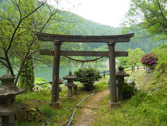
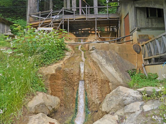
After I took photos at the shrine, I continued on to a small building next to the jetty. This building was complete with an odd wooden structure, from which water was streaming. Upon closer inspection (and after getting our hands burned) my colleague and I deduced that this was in fact the source of the local hot spring water!
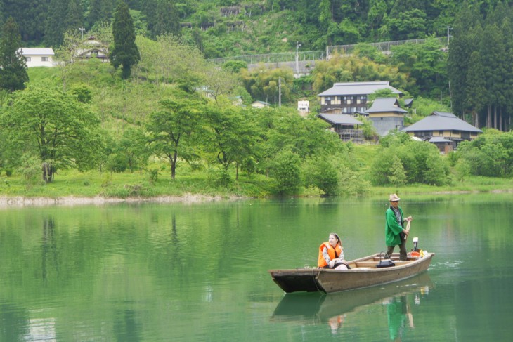
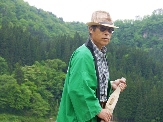
It wasn’t long before Hoshi san made his dramatic entrance on his wooden boat. He looked awesome in his sunglasses and happi robe (happi 法被).
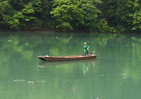
After getting kitted up with a life jacket, Hoshi took me across the ravine.
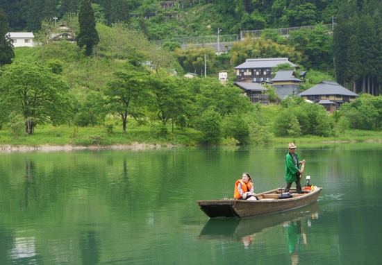
It was so relaxing to be taken across the surface of the Tadami River. It struck me while taking the ferry across the ravine that I couldn’t hear any of the busy noises of the city that can make you feel stressed or distracted. In fact, the only sounds I could hear were the wind, the birds, and the slow rhythmic paddling of Hoshi san’s oar gliding through the surface of the river.

Hoshi san’s recommendation for enjoying the best Mugenkyo Ferry experience is to lie flat on your back in the middle of the boat and have a nap. I’m not sure whether his customers can actually do this, or if it’s just something he’s been able to try, but it sounds amazing!
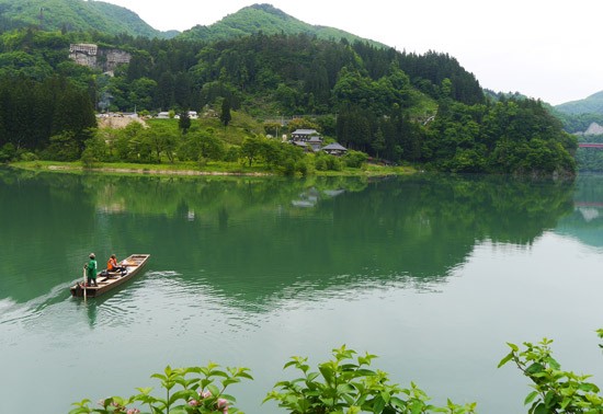
The journey to the other side of Mishima Town takes 30 minutes one way, during which time you get some great views. It was really cool to see buildings like the Tsuru no Yu onsen from such a different angle. The reflections looked amazing.
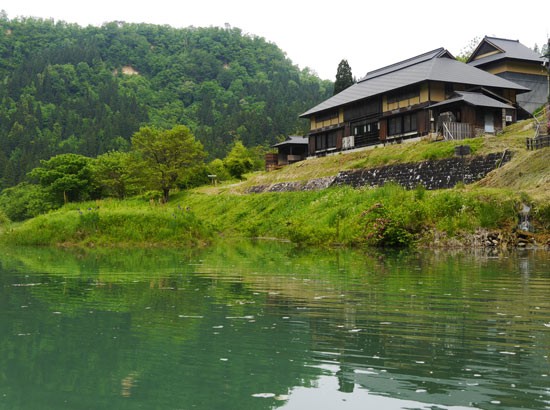
Tsuru no Yu Onsen is a great hot spring in the Oku-Aizu area of Fukushima Prefecture. Unfortunately, I have yet to take a dip, but I definitely want to go soon. Knowing how relaxing it was to be on the ferry, I can just imagine how amazing it would feel to chill out in the onsen looking out over the Tadami River.

One thing that visitors should note about visiting Tsuru no Yu Onsen, however, is that the open-air baths (rotenburo 露天風呂)are totally exposed to the elements. Seeing as the only thing surrounding the onsen is a river, usually this isn’t an issue, but I can say firsthand that people in the open-air baths can definitely be seen from the ferry!

I actually had to edit the naked guys who were sitting on the edge of the bath out of the photo below…
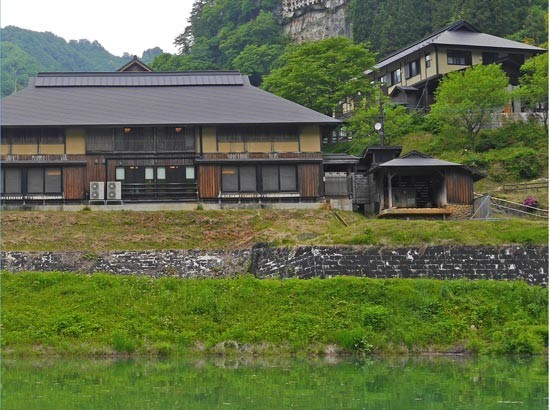
These sightseeing ferries are made from boats that were used by local people crossing between areas of the Mishima area over 50 years ago. For Japanese people, riding in one of these boats is very nostalgic.

The running of sightseeing ferries between the different areas of Mishima began in 2010 but was halted in 2011 when the Great East Japan Earthquake caused infrastructural damage to Mishima and surrounding areas. The ferry service was restarted in 2017.

If you visit the area and travel on the Mugenkyo Ferry during the early morning in summer, you’re likely to get to see picturesque mist atop the Tadami River. This makes for some very beautiful photos.
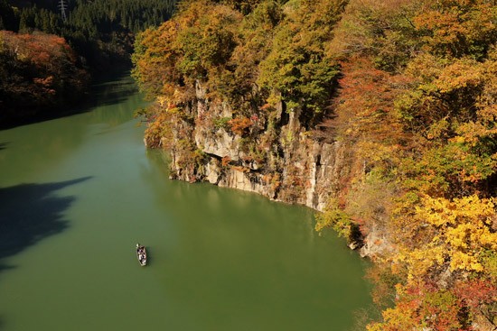
The Mugenkyo Ravine Ferries are operated by Kenko Hoshi, an extremely talented local photographer who specializes in capturing the beauty of Oku-Aizu and the Tadami Line. Kenko Hoshi has an incredible amount of energy and enthusiasm for his hometown.
Below are just a couple of photos taken of the Mugenkyo Ferry by Hoshi san. It’s quite possible that if you have seen photographs of the Tadami River No. 1 Bridge they were probably taken by him.
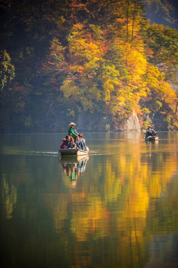
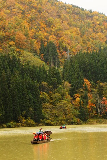
Hoshi san was brought up in Mishima Town, on the opposite side to where visitors start their journey. Hoshi san’s hometown area is now what is known as a ‘haison 廃村’ or ‘ghost town’.

The ground on which the town was built is prone to landslides. As a result, the area has fallen victim to a number of related disasters over the centuries. A really intense landslide hit Mishima in 1964 and finally forced the local people to move to the opposite side of the Tadami River. Nothing was left behind, save for one traditional farmhouse built 300 years ago, a shrine, temple, and Buddhist statue.
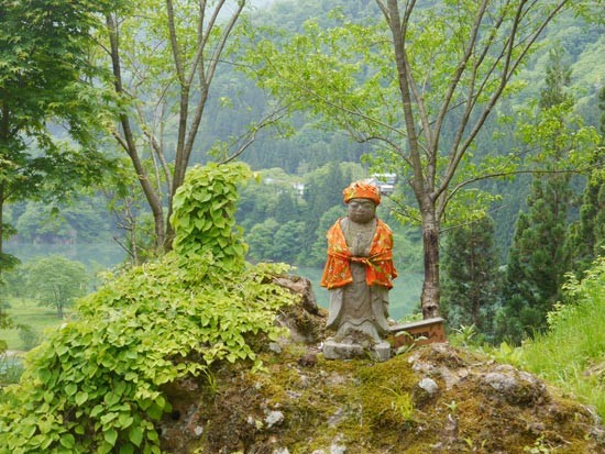
I wholeheartedly recommend this experience as something to try out when traveling on the Tadami Line, as it is easily accessible from Hayato Station. It’s a must-visit for those hoping to see countryside Japan during their visit to the prefecture, as well as for those who are passionate about photography like myself.
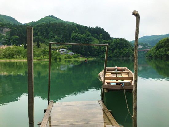
If you’d like to take a journey on the Mugenkyo Ferry, please take a look at the information below!

BASIC INFORMATION*

*Correct as of August 2023

  • Boats run throughout the day between late April and November.
  • The journey takes 45 minutes both ways (participants do not get off the boat until they go back to the start).
  • In summer, the boats run between 6:00 AM and sunset.
  • If you’d like to see the picturesque Tadami River mist, it’s best to ask for Hoshi’s recommendation regarding the best day (and time of day) to visit.
  • See more information (from Oku-Aizu Tourism) about the Mugenkyo (Mugenkyo no Watashi) here.
  • Hoshi san can’t guide you in English, so he won’t be able to guide you around the deserted town on the opposite side of the river.


HOW TO BOOK

PRICE

  • Flat fee of 6,000 yen for 1 or 2 people. Additional 3,000 yen per additional person for three or more people (three people: 9,000 yen; Four people: 12,000 yen, etc.)
  • Up to 8 participants per time.

CHOOSE A MEETING POINT

  • When you reserve, make sure to state whether you’d like to meet Hoshi san or his colleague at the main jetty near Tsuru no Yu (where I met him), or if you’d like him to come meet you at Hayato Station, on the Tadami Line. See here for the Tadami Line train schedule.
  • If coming by train, make sure to tell the staff what time of day your train will arrive.

FINDING THE TSURU NO YU JETTY

  • If you are driving, park at Tsuru no Yu Onsen.
  • Walk down to the water’s edge.
  • There will be a shrine nearby and a small wooden building near the jetty.

OTHER INFORMATION FOR VISITORS

  • As of summer 2020, there are a number of portable toilet facilities close to Tsuru no Yu, for customers of the Mugenkyo ferry.
  • The ferry will run even in case of rain or wind (please bring an umbrella). Appointments may be canceled in case of heavy rain.

Latest posts

  1. Destination Spotlight

    A Guide to the Aizu Festival – And How to Join Yourself

    If, like me, you’ve been watching Shogun on Disney+ and been blown away by its dramatic depiction of Japan’s Sengoku (warring states) era, you might be interested in learning more about samurai history during your trip to Japan.Fortunately, there are plenty of options for someone looking to get involved with samurai culture.Tsurugajo Castle severely damaged after the Siege of Aizu in 1868.The Shogun’s Last StandOne of the best places for this is the historic city of Aizu-Wakamatsu on the west side of Fukushima Prefecture. Before the advent of prefectures in the Meiji Restoration, this region was ruled by the Aizu Domain, a powerful clan of samurai who remained loyal to the shogun even after ruling authority was returned to the Emperor in the 1860s.This culminated in the Boshin War of 1868, when imperial forces moved north and besieged Tsurugajo Castle at the heart of the Aizu Domain’s sphere of influence. Though the defenders were ultimately defeated by the Emperor’s modernised troops, the fortress remained standing, and this would be remembered as one of the final battlefields of Japan’s shogunate history, before it became what we recognise as ‘modern’ Japan.The Aizu FestivalAlthough Aizu is now incorporated into the wider Fukushima Prefecture, the roots to its powerful ancestor run deep in this part of the country. Local people come together every September to hold the Aizu Festival, honouring the warriors who walked these roads centuries ago with a series of events, processions and performances.Most notable is the parade on the Sunday of the festival. Schools, organisations and local residents of all ages dress in the traditional garb of every strata of Aizu clan society, and walk through the city streets waving to hundreds of attendees. Possibly most striking are the samurai lords, who proceed on horseback.Popular actress Ayase Haruka, who played the ‘Japanese Joan-of-Arc’ Nijima Yae in an NHK drama in 2013, reprises her role every year in the procession and gives a speech before the main parade.The procession starts with a short walk through the grounds of Tsurugajo Castle itself, leading to an opening ceremony held on the lawn under the shadow of the fortress.The samurai lords sit together on the dais, while an announcer heralds each samurai troop that enters the field. This also includes Western historical figures of import and significant noblewomen of the time in traditional dress.Once all the participants have entered and taken their seats, the opening ceremony takes place, with speeches from the city mayor and visiting dignitaries, samurai performances, and gunnery displays.This ceremony is also viewable to the general public, although it’s best to get to the castle early as the spectators’ area typically gets busy.How to Join the ProcessionThe 2024 rendition of the Aizu Festival was beset by heavy rain, but visitors still turned out in huge numbers to watch the procession. This also included an international troop comprised of local residents from a variety of countries: England, Scotland, Canada, the US, Australia, Taiwan and Japan.This experience, organised by a local tour company, is aimed at making Japanese culture more accessible to residents and visitors from overseas. It also included an English-speaking guide, who explained to us not only about the history of the area, but helped with logistical elements – how to dress in the traditional gear, where to go, and how to put our swords away properly...Our troop dressed in the dark navy armour of foot soldiers of the Aizu gunnery units, who were trained both in muskets for ranged combat and katana-style samurai swords for melee. As such, each soldier of the troop was given one of each, as well as a banner of the Aizu Domain (which, for the record, is very easy to bump against door frames and street signs).With the onset of the bad weather, the festival organisers made the difficult decision to protect the traditional armour from water damage with protective rain gear. Although it took away some of the mystique of the samurai atmosphere, it was better than the parade being cancelled altogether, and the rain made for some dramatic photos.Despite the weather, we were cheered on relentlessly by local people throughout the parade route. The main street of Aizu has covered sidewalks, so it was along this route that saw the most spectators, and where the samurai troops performed their main war cries.Overall, we walked for a little over two hours, but including the time to get changed and the opening ceremony, we were in Aizu from about 8:00 in the morning to around 13:00 at lunchtime.The international troop will be recruiting in 2025, too, so if you’re looking to join, feel free to send us an email to i-info@tif.ne.jp and we’ll keep you posted when bookings open.Visiting AizuFor more information about the festival, see our page here.Looking for more samurai experiences in Japan? Try the monthly kengido experience, learning samurai sword techniques in a historic dojo in the mountains.

    A Guide to the Aizu Festival – And How to Join Yourself
  2. Destination Spotlight

    Following Fukushima’s Footpath: A Forest Walk in Nishigo

    The tranquil village of Nishigo (西郷村) is situated just west of Shirakawa City, a naturally abundant region at the south of Fukushima Prefecture. We met with a group of community leaders, tour guides and members of the local government to take a Foothpath Tour around its many sights.What is a Footpath Tour?Inspired by the British culture of taking countryside walks in spots of natural greenery, Fukushima Footpath Tours encourage visitors to local areas to wander around and explore the nearby region.In particular, by walking through smaller and lesser known areas, eating at local restaurants, and interacting with town residents, you can play a role in Fukushima's diaster recovery efforts.A big part of the intrigue is visiting an area that people are less likely to frequent than famous tourist sites and discovering interesting places - perfect for people who like taking photos!Although there are self-guided tours available - take a look at our guides for Katsurao and Tamura - our tour featured about twenty visitors, and was led by a local long-term resident.Getting Back to NatureMy outstanding impression of our tour - and this, suitably enough, reminds me of similar walks back in the UK - was the abundance of woodland and the fantastic scenery.Our group worked its way through narrow corridors of beautiful pine trees, the terrain occasionally sloping up into the canopy, and wherever we went, we stumbled on to something interesting. Most striking was when we came to a clearing on the banks of the Abukuma River.We took a break here to take in the scenery. Later, when we shared our opinions of the tour, this was the highlight for many of us, thanks to the calm atmosphere and relaxing sound of the flowing river.Some people took this time to skip stones or try out the tree swing.Hidden TreasuresOne of the benefits of having a local resident show you around is that wherever you go, you can ask questions about the things you stumble across. Our guide also often pointed out local stores and workshops and told us about the crafts or folk art that they specialised in.The deeper we went into the woods, we also found some old abandoned houses, which had an intriguing, eerie atmosphere, and the local Christian church.A Well-Earned RestBy the time we made it back to base camp, we'd been walking for about two hours, doing a loop of the main woodland area of Nishigo. We were starting to run low on energy, making it the perfect time for lunch - our guide had been cooking since before we arrived, and a huge pot of Japanese curry had been bubbling the entire time we'd been walking.That meant the flavours had infused deeply into the sauce, and combined with the use of local Nishigo vegetables and rice, this was exactly what we needed after a long walk.Our tour was a really valuable experience - for me, the main attraction was having the chance to visit somewhere most tourists wouldn't usually go, learning about the area from someone who knows it well, and enjoying the peaceful woodland atmosphere.More informationInterested in trying a Footpath Tour for yourself? You can learn more here (please be aware that this page is in Japanese). 

    Following Fukushima’s Footpath: A Forest Walk in Nishigo
  3. Destination Spotlight

    Among a Sea of Clouds – Climbing Mt. Issaikyo

    Learn more about Mt. Issaikyo on our dedicated webpage. Despite Japan being such a mountainous country, and having lived here for several years, I was surprised to realise I’d never climbed to the summit of a Japanese mountain before. But that all changed recently when I attempted – and defeated, just about – the rugged trip up Mt. Issaikyo, one of Fukushima’s most popular hikes.Here's all the information about not only my trip, but how you can take on this challenge as well.Base Camp: JododairaOverlooking the Jododaira Plateau, the summit of Mt. Issaikyo (1,949m) is one of several possible trips from the Jododaira Visitor Center to different areas of the surrounding Azuma-Bandai mountain range.Many visitors head for the Kamanuma pond to the west or Okenuma pond to the south, both of which offer spectacular views over the water and are particularly stunning when the leaves change colours in autumn. Both of these trips, as well as the climb up to the nearby Mt. Azuma-Kofuji crater, are shorter and less intensive walks accessible to any experience level.The nearby Visitor Center is also a great spot to enjoy lunch; there is a traditional shokudo (canteen) style restaurant that serves classic Japanese staples like curry and ramen. There’s also a souvenir shop, a great place to pick up snacks or Fukushima goods like the iconic akabeko red cow.The Jododaira area in general is well known as being a volcanic one – a major eruption from Mt. Azuma-Kofuji in 1888 created hundreds of lakes, including the popular Goshiki-numa, and the hot mountain spring water serves nearby onsen hotels to this day. Sometimes you’ll see local construction staff wearing gas masks to protect against volcanic gases when exposed for long working days.The Climb: Leg DayAs a first-time hiker, I was a little apprehensive about the journey to the summit, but the initial stretch of the journey was easy – a leisurely walk along the boardwalk through the marshlands heading into the foothills.From there, the path begins to become rockier, steeper and less steady, and this largely continued for the remainder of the hike. There are plenty of natural rest stops on the way, however, including a mountain hut with toilets and medical supplies in case of an emergency.Also, this route provides fantastic views over Azuma-Kofuji. Although it was easy to feel some jealousy towards the visitors who chose the easier hike (only 10 minutes up the steps from Jododaira, then a 45 minute stroll around the crater), the gorgeous weather made for some beautiful photos.Although the volcanic crater is visible further up Mt. Issaikyo, on occasion it was obscured by the rocky slope or by the shifting cloud cover, so the best photo spot was probably somewhere halfway up the ascent.This was also where we met many hikers coming back down the mountain in the opposite direction, many of whom greeted us warmly and wished us luck on our climb.The SummitBy the time we made it to the top, our tired legs and lungs certainly needed a rest, but we were rewarded with breathtaking views of pristine white clouds stretching as far as the eye could see. In contrast to the view from Azuma-Kofuji, which looks across the green expanse of Fukushima City, being surrounded by clouds made it feel like we’d stepped into another world.From here, we wandered slightly to the western part of the summit, where from over a gravelly slope we spied the view that attracts intrepid hikers from all over Japan.Known as Majo-no-Hitomi or ‘The Witch’s Eye’, this flawless lake of crystal blue is truly a sight to behold, and definitely made the tough climb worthwhile.The Descent... in the Wrong DirectionTempted for a closer look, we headed down the steep slopes that lead off the summit. The grip underfoot here can be rocky and unsteady, so this was where my hiking boots came most in handy. Once we got into the more forested areas again, the path occasionally fell away into a slight drop, too, so some very light mountaineering was required.The journey from the summit down to the Witch’s Eye took about thirty minutes, and again we were awestruck:The beauty of the lakefront was even more striking up close, making it the perfect place to stop and recharge our batteries with a quick lunch by the water. We spent another half an hour down here, taking a much-needed rest and enjoying the perfect summer weather.All that was left was to climb Mt. Issaikyo for the second time on the day, and we would be on our way home...By the time we made it back to Jododaira, the fine weather from earlier has dissipated and a deep fog had settled in.The round trip from Jododaira to the summit of Mt. Issaikyo, down to the Witch’s Eye, and back again, took us roughly five and a half hours (stopping for 30mins for lunch), and saw us walk the equivalent of 7.4km.Looking to climb Mt. Issaikyo for yourself? Some important advice: Wear sunscreen! Despite the shaded areas, large parts of the hike are exposed to the elements. Bring plenty of water, and snacks or lunch to keep your energy up! Hiking boots are highly recommended. The mountain is closed to climbers in winter.Looking for more hikes in Fukushima? Consider Mt. Adatara or Mt. Bandai.

    Among a Sea of Clouds – Climbing Mt. Issaikyo
Top