Furoyama Park Yama-tsutsuji (Mountain Rhododendron)

Furoyama Park Yama-tsutsuji (Mountain Rhododendron)

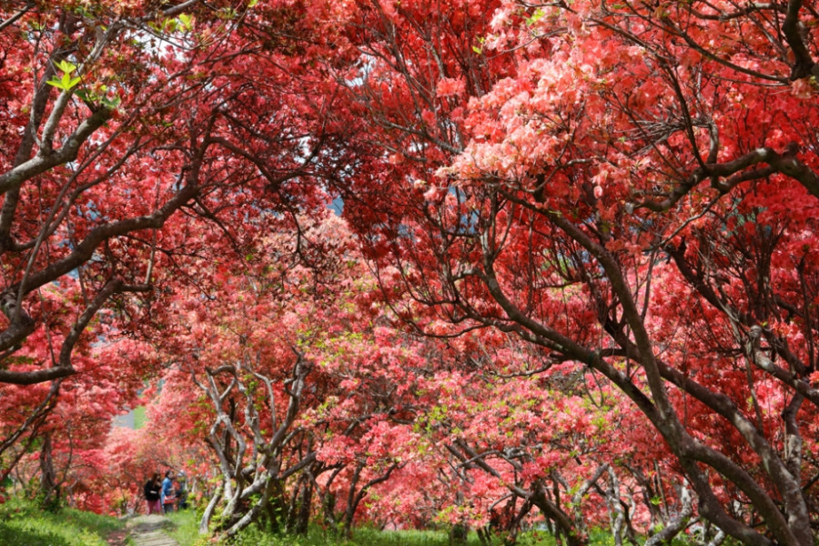
The famous Okukuji Prefectural Nature Park in Ibaraki Prefecture designated Furoyama Park as a top Green Spot of Fukushima. Furoyama Park is famous for its yama-tsutsuji (mountain rhododendron), which come into bloom from late April through to early May. There are around 3,000 rhododendron plants which cover the park in deep shades of red. Climb halfway up the hill to gain a great view of the town.

Venue Details

Venue Details
Websitehttps://www.kanko-hanawa.com/(Japanese)
Contact

Hanawa Town Tourism Association

(+81) 247-43-3400

Best Season
  • Spring
Parking5 cars (municipal parking also available)
Entrance Fee100 yen
Related infoBest time to visit: Late April to early May


<a href="http://hanawa-kanko.com/pamphlet "> See here</a> for multilingual pamphlets published by Hanawa Town Tourism Association.
Access Details
Access271-1 Sakuragi-cho, Hanawa, Hanawa Town, Fukushima Pref.
View directions
Getting there

By Car: 70 min from Naka I.C. exit off the Joban Expressway via Route 349. (Or 45 min drive from the Shirakawa I.C. exit off the Tohoku Expressway, via Route 289 or Route 118)

By Train: 15 minutes walk from Iwaki-Hanawa Station on the JR Suigun Line

Nearby

The World Glassware Hall
Nature & Scenery

Totsube Cherry Tree

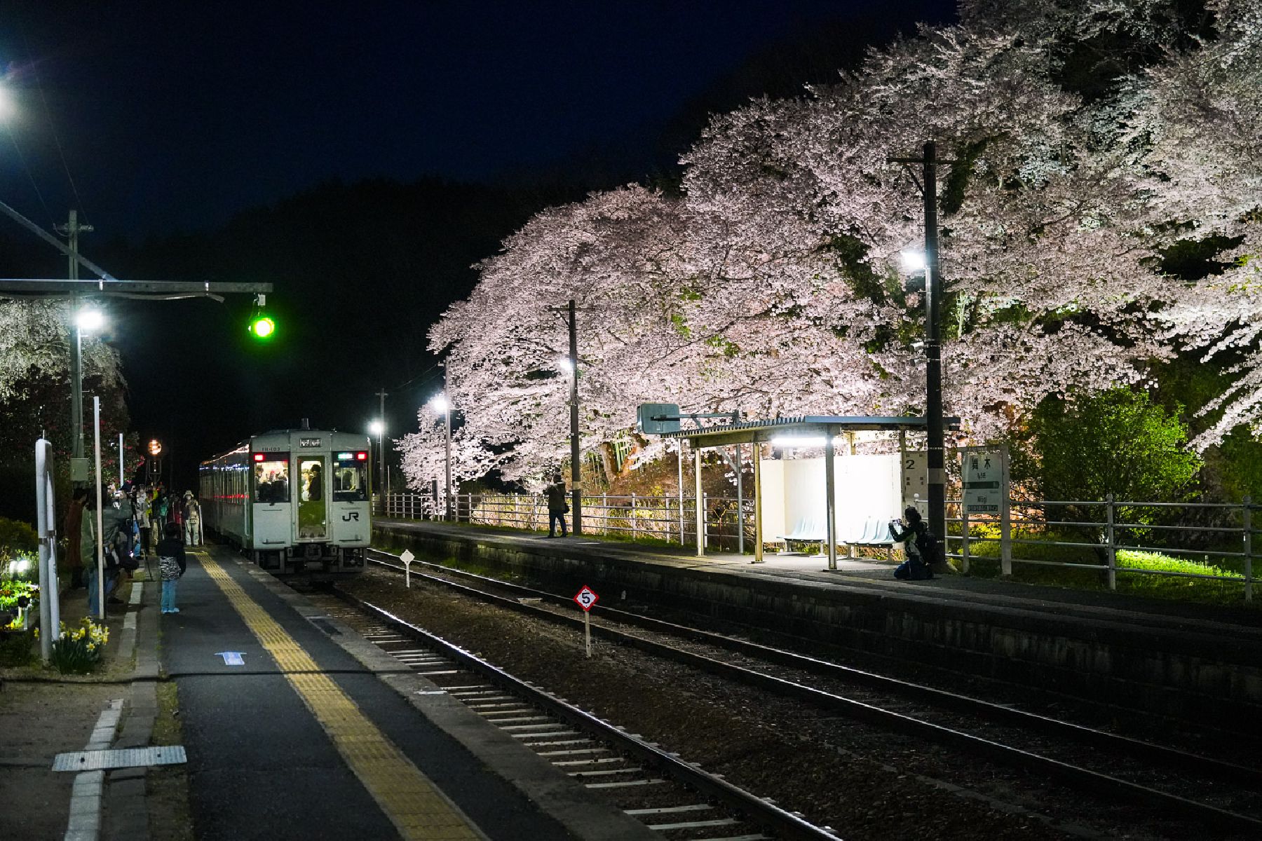
The Totsube Sakura tree is one of the best-known cherry blossom spots in Fukushima. Standing alone in a field in Yamatsuri Town, its wide branches and soft pink flowers create a striking scene against the surrounding countryside. The tree is especially famous for blooming slightly earlier than many other cherry trees in the area and is seen as a symbol of the spring season starting in the prefecture.Believed to be more than 600 years old, the tree is an Edohigan cherry tree and has been designated a natural monument by the prefectural government. It stands around 18 metres tall, with a trunk more than six metres in circumference, showing both its great age and remarkable size.For generations, local farmers used the blooming of the Totsube Sakura as a sign that it was time to begin spring work in the fields. Because it flowers from late March to early April, it became closely tied to the rhythms of life in Yamatsuri and remains an important symbol of the town today.The tree is also popular with photographers, especially because the nearby Suigun Line railway passes behind it. During blossom season, many visitors gather to capture the sight of a local train passing beneath the ancient cherry tree.

The World Glassware Hall
Nature & Scenery

Hanamomo-no-Sato Park

From early April right up to the start of May, 40 varieties of blossoming peach trees present a feast for the eyes for visitors to Hanamomo-no-Sato Park. There are over 300 peach trees spread across the 8,000 square meters of land. From blossoms with a single layer of petals, to the elaborate Yae-zakura and Kikuzaki Sakura flowers, there is a huge variety in the shapes and colours of cherry blossoms to be discovered and enjoyed at Hanamomo-no-Sato Park. As well as being free to visit, Hanamomo-no-Sato Park is conveniently located; just 20 minutes on foot from Iizaka Onsen Station.

The World Glassware Hall
Nature & Scenery

Kaiseizan Park

Koriyama’s Kaiseizan Park is a wide realm in the city. Home to around 1300 cherry trees, it is one of the prefecture’s most prominent cherry blossom spots. The impressive trees are lit up in the evening during cherry blossom season, making for fantastic views. The park has a baseball field, an athletics field, and an event venue. Additionally, it is home to one of Fukushima's Chansey's Lucky Parks, making it a popular destination among Pokémon fans. Located nearby is the Kaiseizan Daijingu Shrine.There is also a 3,000-square-meter rose garden that blooms in spring (typically from mid-May to late June) and in the fall (usually from mid-September to late October). Exact blooming dates vary each year.No matter the season, there is something to enjoy at Kaiseizan Park year-round.

You might also like

Mt. Shinobu (Shinobuyama)
Nature & Scenery

Mt. Shinobu (Shinobuyama)

Mt. Shinobu, with a total altitude of 275 meters, is one of the most recognisable landmarks of Fukushima City. It is estimated that it formed about 500,000 years ago when the Fukushima basin caved in and Mt. Shinobu became an isolated hill, which later became the object of multiple local poems, stories, and legends.Visitors can hike up Mt. Shinobu for unobstructed views of the cityscape. Hikers of all levels can try climbing Mt. Shinobu, as its peak can be reached in a few hours and many parts of it can be reached by car.Each year in April, there is a spring festival with cherry blossom night illuminations that attract hordes of visitors. Summer and autumn are also great times to follow the hiking routes on Mt. Shinobu.A spiritual power spot for locals, Haguro Shrine can be found at the top of the central peak, where there is also a giant straw sandal that weighs about 2 tons and is 12 meters in length and is believed to be among the biggest in Japan. The sandal is paraded along Fukushima City each year in August during the Waraji Festival. Also in Mt. Shinobu, you can find the Shinobuyama Neko Inari Jinja (‘cat shrine’), and the Gokoku Shrine, along with several parks.For stunning views of the city, including the Shinkansen bullet train tracks, head to the Karasugasaki Observation Deck on the western side. Located nearby are the Fukushima Prefectural Museum of Art and the Fukushima Prefectural Library.

Irimizu Limestone Cave (Irimizu Shonyudo)
Nature & Scenery

Irimizu Limestone Cave (Irimizu Shonyudo)

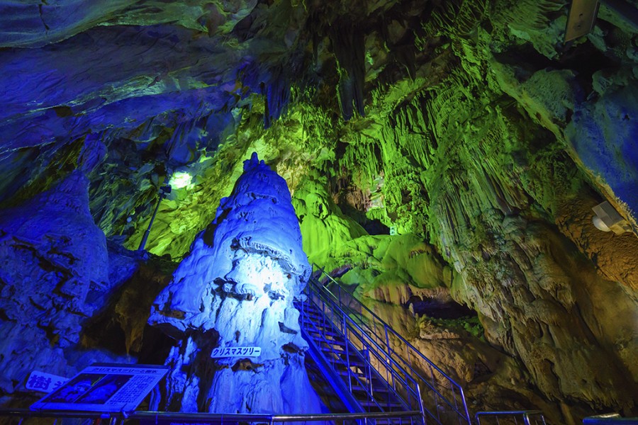
Visitors looking for a cool and adventurous experience should consider visiting the Irimizu Limestone Cave (入水鍾乳洞) in Tamura City.Perhaps less known than the nearby Abukuma Cave, the Irimizu Limestone Cave offers visitors the opportunity to venture into its depths—the narrow cave is 900 m in total and is divided into three courses (A, B and C), each more extreme than the previous one.Visitors should bring adequate clothing and shoes, as the inside of the cave is wet and slippery with irregular rocky ground and gushing streams.Course A is the least extreme, and the way into the cave is lit, although there are puddles and wet spots, and you will need to duck in some places since there are short and narrow spots. Course A is 150 m long and takes approx. 30 minutes to complete.Courses B and C go through an area of the cave where there is less conditioning. Visitors have to walk while having water up to their knees and go through slippery and narrow gaps by candlelight or flashlight.Course B is 450 m and takes about 60 minutes to complete, while course C is 300 m and takes about 90 m to complete. Visitors hoping to undertake course C, the most difficult of the three, have to make a reservation before their visit, as the course can only be completed alongside an experienced guide. *Course C is not available and is not taking reservations as of May 2023.The temperature inside the cave is typically between 10 and 15 degrees regardless of the season.There are candles, rubber shoes, flashlights and other items available for renting at the entrance.Prices are as of March 2023.The cave has been designated as a National Natural Treasure, and it’s easy to see why. You’re bound to become a geology enthusiast after experiencing the charms of the cave.

Koori Town's Peach Blossoms
Nature & Scenery

Koori Town's Peach Blossoms

Koori Town, home to some 236 acres of peach orchards, is a wonderful place to view peach blossoms when spring rolls around. 24,000 trees fill the 120 hectares of peach orchards located along the banks of the Abukuma in Koori Town's Danzaki area - many of these are located along a road known locally as 'the Peach Line'. When these flowers all open their petals in unison, the landscape is transformed into a sea of pink, truly a utopian vista. Their Majesties the Emperor and Empress (the Crown Prince and Princess at the time) walked through this orchard on April 26 1996 - an event which is commemorated with a memorial tablet that stands along the Peach Line. Visitors to the peach orchards on the banks of the Abukuma river will be treated to views of Mt. Handa, the symbol of Koori Town. The best time to visit the peach orchards is mid-April.

Mt. Issaikyo
Nature & Scenery

Mt. Issaikyo

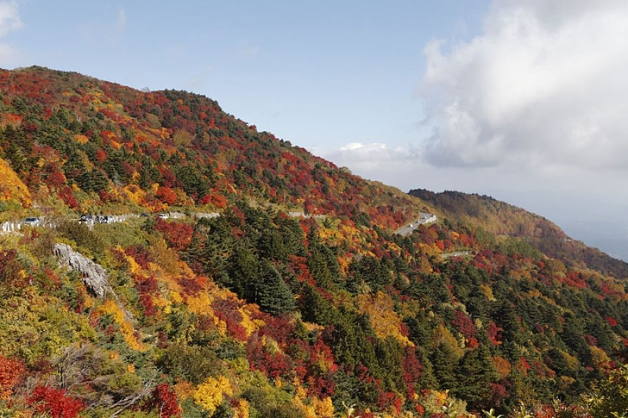
One of the mountains climbable from the Jododaira Plateau, Mt. Issaikyo is a robust several-hour hike suitable for intermediate-level hikers.In addition to spectacular views of the surrounding area, the mountain is also one of the main pathways to, and viewpoints for, the ‘Witch’s Eye’ lake at Goshikinuma, which stretches out in a valley visible from the Issaikyo summit. (The lake is reachable from the summit, although the terrain is relatively steep.)Visitors to the area typically park at the Jododaira Visitor Center, from which they have a choice of options: Kamanuma lake due west, Okenuma Pond to the south, and the Azuma-Kofuji crater with its panoramic views over Fukushima City to the east.To the north, however, stands Mt. Issaikyo. With a summit of 1,949m and rugged terrain on the climb, it may not be suitable for absolute beginner hikers, but nor is it a whole-day slog like climbing Mt. Fuji. Views from the top of the mountain are spectacular and well worth the climb – a blanket of immaculate white clouds spreads out in all directions. Likewise, the ascent gives great views of the Azuma-Kofuji crater with its iconic inverted shape.The Jododaira Plateau is typically best accessed by car, a journey which takes travellers from Fukushima City up the Bandai-Azuma Skyline sightseeing road and offers fantastic views, especially in autumn.Please be aware that the Mt. Issaikyo trail, and the Jododaira Plateau in general, is closed to visitors during winter due to heavy snowfall.

Top