Ozegahara Marsh

Ozegahara Marsh

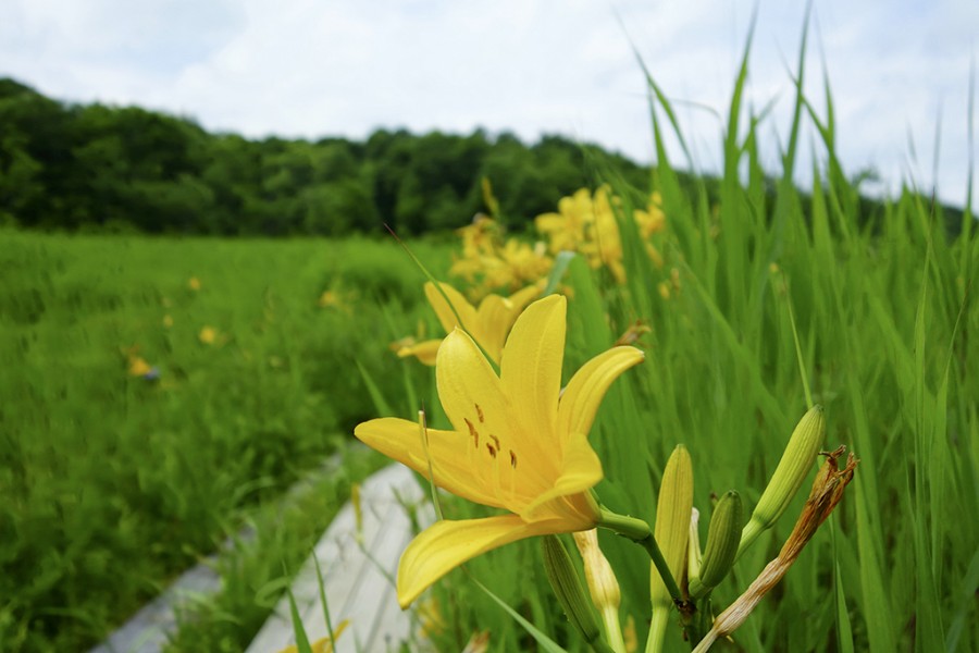
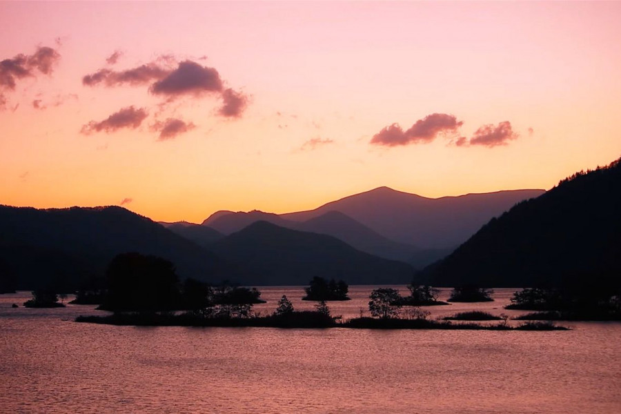
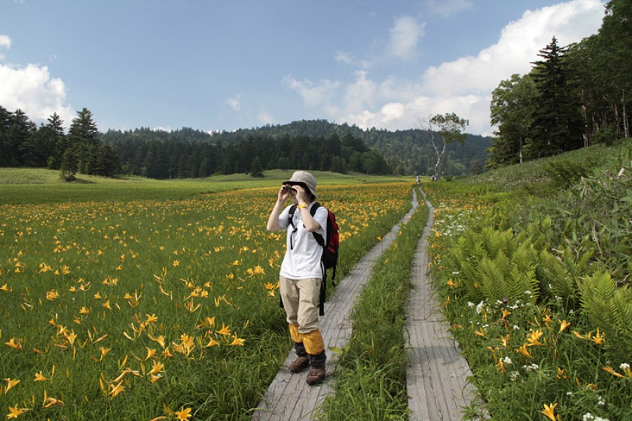
Ozegahara Marsh is a high-altitude marshland located in Oze National Park. This 8 square kilometer marshland is a popular hiking destination and is home to some rare plants, including white skunk cabbage, Nikko Kisuge, and Watasuge (a variant of cottongrass). Hiking trails at Ozegahara are well-maintained and used almost year-round for hikers, except in winter when the park is often closed due to snow. Being just 150 kilometers from Tokyo makes Ozegahara and the rest of Oze National Park a popular getaway from city life. Some people will even drive up early in the morning, hike the day away, and then return to Tokyo the same day. It’s admittedly a tough trip if you choose to do it all in one day. Instead, why not stay the night in one of the overnight lodgings and huts within the park grounds? There's also the option of staying at a minshuku (private homes that provide meals and lodging for tourists) in Hinoemata Onsen town. However you choose to travel to Ozegahara, you won’t be disappointed. The marshland has hundreds of small pools that are a beauty to admire. Two mountains, Shibutsusan and Mt. Hiuchigatake, almost seem to stand guard over those who admire the lovely marshland scenery. The most popular trail to hike is the Hatomachitoge, as it is only a one-hour walk from the western end of the marshland. Visit in late May to early June to enjoy the famous white skunk cabbages as they bloom across Ozegahara. In July and August, the marshlands are painted a gentle yellow by the Nikko Kisuge flowers. And in September and October, the autumn colors bathe the marshland in bright gold and crimson.

Venue Details

Venue Details
Websitehttp://www.pref.fukushima.lg.jp/w4/oze/en/
Contact

The Oze Preservation Foundation

(+81) 27-220-4431

Best Season
  • Summer
  • Autumn
Related infoFor more information about hiking in Oze National Park (including information about parking lots, mountain lodges, hiking trails and more) please check out the links below.

<a href="http://www.pref.fukushima.lg.jp/w4/oze/en/">- Fukushima Prefecture's Oze National Park Access Website</a>

<a href="https://www.oze-fnd.or.jp/en/rg/">- Oze Preservation Foundation Site</a>
Access Details
AccessHiuchigatake, Hinoemata Village, Minamiaizu District, Fukushima Pref. 967-0531
View directions
Getting there

Reaching the Numayama-toge Pass Trailhead for Ozegahara Marsh or Mt. Hiuchigatake via Ozenuma:

  • You can reach this trailhead by bus from Aizukogen-Ozeguchi Station (Aizu Railway Line) via a 2 hour bus ride (Aizu Bus Co.)
  • The trailhead location and address is shown above.

Nearby

The World Glassware Hall
History & Culture

Isasumi Shrine

Isasumi Shrine's history is thought to be connected to how the Aizu region got its name - a story that has been recorded in two of Japan’s most legendary books of folklore. According to the tale, around 2000 years ago, four shogun were entrusted with uniting the four areas of land which would become Japan. Two of these shogun happened to be father and son. One was sent to the northeast, and the other to the northwest.When the father and son had completed their work uniting the towns in their respective areas, they met in the middle. They named the area “Aizu” (会津), which can be translated as “The riverbank (津) where we met (会)”. The father and son travelled to Mt. Mikagura-dake, a mountain that borders Niigata Prefecture and Aizu, and prayed to the Shinto god of pioneering new lands to protect Aizu, and the rest of Japan. Isasumi Shrine is thought to be built where they met.In spring, the shrine grounds become decorated with the blossoms of one of the most prized cherry trees in Aizu. It is said that this tree, which is named Usuzumi Sakura (“Diluted-Ink Sakura”), has been the sacred tree of Isasumi Shrine since it was brought down from Mt. Mikagura-dake and planted in the shrine grounds as a way of commemorating the efforts of the father and son. The lovely, light scent of the cherry blossom welcomes visitors each spring.Aizu Misato Town’s historic Isasumi Shrine, known as a great spot for viewing beautiful irises, holds a festival to celebrate the splendor of these flowers every year.

The World Glassware Hall
History & Culture

Maezawa L-shaped Farmhouses

The deep snows of the Aizu region meant that, in the past, cut off from other areas for months at a time, its residents had to use all their wits just to make it through the winters. These L-shaped farmhouses known as "magariya" conceal a number of the innovations developed by this local people.As you can see in the layout of the house, the long earth floor stretches out towards the road. Long ago, horses were indispensable in farming, but the deep snow of winter meant that keeping them tied up in external stables was cruel. Therefore, stables were built into the house, meaning that the unfloored working area inevitably became larger. Having this area far from the road made getting to the road through the snow more difficult, as up to a meter can fall overnight. Accordingly, with the aim of reducing work, locating this working area as close as feasible to the road ended up with the house being laid out in an L-shape.Many of these houses were built in Maezawa and throughout Tateiwa Village, as a way of living with horses in the deep snows of the Aizu region.The houses have become more and more comfortable over time, with the "magariya" design lasting until the present day. While this magariya-style farmhouse used to be built everywhere that saw heavy snow, they are gradually disappearing. Accordingly, the Maezawa magariya have been designated as historical cultural assets.In 1985, the village began actively preserving these houses, and this area now attracts many visitors. One of the magariya buildings have been repurposed into a museum in the village where visitors can learn about life in Maezawa.

You might also like

Kagamizakura
Nature & Scenery

Kagamizakura

Kagamizakura is a huge Sargent's cherry located in the Numanotaira area, Yamato-machi, Kitakata City. Numanotaira is also known as the home of one million Fukujusō (vibrant yellow flowers). Rich with nature, the area contains many wildflowers and wild mountain vegetables. The single Sargent’s cherry is located on the edge of a pond called “Kagami Ike” (lit. Mirror Pond). The age of the tree is unknown but it is estimated to be over 100 years old. The trunk consists of dozens of roots growing from the foot of the tree. The tree's branches spread out widely, making it look as if the tree is leaning over toward the pond. When the flowers of the cherry tree blossom, the scenery with the reflection on the surface of the pond is exceptionally beautiful. The dark pink flowers typical of Sargent’s cherry are simply gorgeous.

Nicchu Line Weeping Cherry Blossoms
Nature & Scenery

Nicchu Line Weeping Cherry Blossoms

The Nicchusen cherry blossoms in Kitakata City follow a three-kilometer section of the former Nicchu Line railway. Once running between Kitakata and Atsushio Onsen, part of the line has been converted into a walking and cycling path. Each spring, rows of cherry trees along the path draw visitors to see them in bloom, usually around Golden Week in late April or early May.The length of the path allows people to enjoy the blossoms at their own pace. Even when some areas are busy, it is easy to find quieter spots for photos or a break. Visitors often walk the full route, stopping at different points to take in the changing scenery.Along the way, there are several features of interest. An old steam locomotive, once used on the Nicchu Line, remains on display at the midpoint and has become a popular photo spot. The path also runs past houses, rice fields, and farmland, giving a glimpse of the everyday landscape of Kitakata.Different types of cherry trees can be seen, from weeping varieties to those with pale or darker blossoms. With open areas to sit and rest, many people bring food or drinks to enjoy a picnic under the trees, making the Nicchusen cherry blossom path a relaxed way to experience spring in Fukushima.

Byobuiwa Crags
Nature & Scenery

Byobuiwa Crags

The Byobuiwa Crags (屏風岩) are a rock formation in Minamiaizu, in the Southern area of Fukushima Prefecture. The rocks have eroded through many years to their current shape. The crags are light in color, offering an interesting contrast with the blue of the gushing Ina river, and the vibrant colors of the surrounding foliage, creating a scenery that becomes particularly poignant during the autumn. Visitors can stroll the walking course around the crags, which takes approximately 20 minutes to be completed and includes several interesting picture spots.

Top