Ashinomaki Onsen Station

Ashinomaki Onsen Station

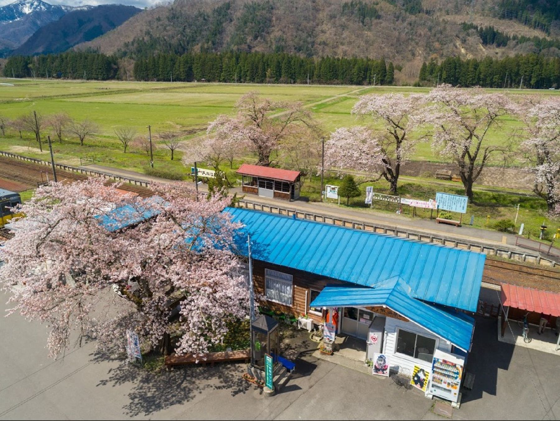
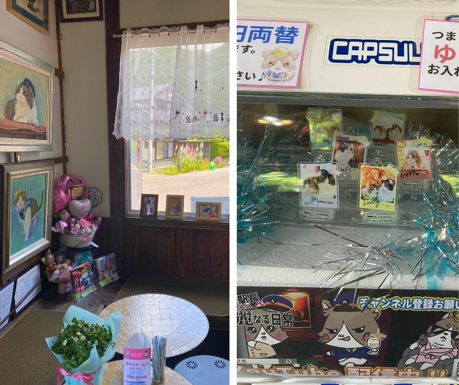
A station located near Ashinomaki Onsen. A cat named Basu from Ashinomaki Onsen was appointed Honorary Stationmaster in April 2008. The current station attendant cat is called Sakura. Souvenirs such as key chains featuring the stationmaster cats are sold inside the station.

Please note that, in order to ensure its wellbeing, it is forbidden to take photos of the station attendant cat. Thank you for your understanding.

Venue Details

Venue Details
Websitehttp://ashinomakionseneki.com/index.html(Japanese)
Contact

Ashinomaki Onsen Station

(+81) 242-92-3776

ParkingAvailable
Access Details
AccessKashu Otomachi, Kamimiyori, Aizu-Wakamatasu City, Fukushima Pref. 969-5122
View directions
Getting there

By Car: 30 min from Aizuwakamatsu I.C. exit off the Ban-etsu Expressway

By Train: It takes 25 min from Aizuwakamatsu Station to Ashinomaki-Onsen Station via the JR Tadami Line

Useful Links

Ashinomaki Onsen

Ookawaso

Ashinomaki Snow Park

Nearby

The World Glassware Hall
History & Culture

Isasumi Shrine

Isasumi Shrine's history is thought to be connected to how the Aizu region got its name - a story that has been recorded in two of Japan’s most legendary books of folklore. According to the tale, around 2000 years ago, four shogun were entrusted with uniting the four areas of land which would become Japan. Two of these shogun happened to be father and son. One was sent to the northeast, and the other to the northwest.When the father and son had completed their work uniting the towns in their respective areas, they met in the middle. They named the area “Aizu” (会津), which can be translated as “The riverbank (津) where we met (会)”. The father and son travelled to Mt. Mikagura-dake, a mountain that borders Niigata Prefecture and Aizu, and prayed to the Shinto god of pioneering new lands to protect Aizu, and the rest of Japan. Isasumi Shrine is thought to be built where they met.In spring, the shrine grounds become decorated with the blossoms of one of the most prized cherry trees in Aizu. It is said that this tree, which is named Usuzumi Sakura (“Diluted-Ink Sakura”), has been the sacred tree of Isasumi Shrine since it was brought down from Mt. Mikagura-dake and planted in the shrine grounds as a way of commemorating the efforts of the father and son. The lovely, light scent of the cherry blossom welcomes visitors each spring.Aizu Misato Town’s historic Isasumi Shrine, known as a great spot for viewing beautiful irises, holds a festival to celebrate the splendor of these flowers every year.

The World Glassware Hall
Nature & Scenery

Nakatsugawa Valley

Nakatsugawa Valley is famous for its beautiful fall foliage. The Nakatsugawa River is a clear stream flowing down from Bandai Kogen (Bandai Highland) to Lake Akimoto. In autumn, the leaves of the many trees, such as maples, alders, and wild cherry trees, turn brilliant and bold colors. The valley can be reached via the lakeside cycling road or by following the trail from the Nakatsugawa Valley Rest House Lake Line Parking Area. Take a relaxing stroll along the ravine while breathing in the mountain air full of healthy negative ions.Many people park on the road closest to the bridge, but for most people it's easier to park at the Rest House and walk the short trail (less than 5 minutes) down to the bridge. There is also a shop and a canteen-style restaurant at the Rest House.

The World Glassware Hall
Nature & Scenery

Mt. Bandai

Originally known as Iwahashi-yama, literally a rock ladder to the sky, the renamed Mt. Bandai is no less impressive. Often referred to as 'Aizu's Mt. Fuji', Mt. Bandai is one of the 100 most famous mountains in Japan, and has even been selected as one of the top 100 geographic landmarks in Japan. In 2011, the mountain was certified as a geopark, which is a unified area with geological heritage and international significance, as defined by UNESCO. There are seven climbing routes for Mt. Bandai, with the trail starting at the Happodai trailhead being the most popular, and easiest route. From the Happodai trailhead, the 3.5 km route takes around 2 hours to reach the summit.The various routes range from 2 to 4 hours and from 3 to 7 km. At Koubou Shimizu, one of the mountain stops, there are two shops where trekkers can buy drinks, snacks, and souvenirs, but please note that there is no accommodation available. For many Buddhist mountain fanatics, Mt. Bandai holds a place of great significance. Enichi-ji Temple, located on the southwestern foot of Mt. Bandai, is a popular temple to visit nearby. The mountains situated around the temple make for a serene vista where one can feel the power of nature. Enichi-ji Temple was founded one year after Mt. Bandai erupted, in 807 C.E.; in the past, some superstitious people believed there was a connection between the eruption and the temple’s founding... Interestingly, Mt. Bandai used to be shaped more like the famous Mt. Fuji, but after a volcanic eruption in 1888, the shape changed to what we see today. It is thanks to that eruption that the mountain gained its rugged, sharp look and the Urabandai area behind Mt. Bandai was created. For non-hikers, the Bandaisan Gold Line is a popular sightseeing road that leads up the southwestern side and offers brilliant vistas of the foliage, especially in autumn when the colors change.

You might also like

Shibuki-gori (Naturally-forming ice sculptures)
Nature & Scenery

Shibuki-gori (Naturally-forming ice sculptures)

If you head to Tenjinhama beach on Lake Inawashiro in the depths of winter, through the trees at its south towards the mouth of the Nagase river, you will see the "shibuki-gori" natural ice sculptures. Lake water is picked up by strong winds from the west, and meets the trees on the coastline. There it creates a very unusual phenomenon with a beauty that rivals the "juhyo" (ice-covered trees) seen at the tops of mountains. Local peoples and visitors alike never tire of these sights. You can also see other shapes formed by ice here, such as ice drifts and the prominent "Omiwatari" cracked, rising ice on the beach and lake surface. Please note that Shibuki-gori are natural ice sculptures, and therefore their appearance and size change by the day. Please check before visiting.

Nakatsugawa Valley
Nature & Scenery

Nakatsugawa Valley

Nakatsugawa Valley is famous for its beautiful fall foliage. The Nakatsugawa River is a clear stream flowing down from Bandai Kogen (Bandai Highland) to Lake Akimoto. In autumn, the leaves of the many trees, such as maples, alders, and wild cherry trees, turn brilliant and bold colors. The valley can be reached via the lakeside cycling road or by following the trail from the Nakatsugawa Valley Rest House Lake Line Parking Area. Take a relaxing stroll along the ravine while breathing in the mountain air full of healthy negative ions.Many people park on the road closest to the bridge, but for most people it's easier to park at the Rest House and walk the short trail (less than 5 minutes) down to the bridge. There is also a shop and a canteen-style restaurant at the Rest House.

To-no-hetsuri Crags
Nature & Scenery

To-no-hetsuri Crags

A national natural monument, To-no-hetsuri Crags consists of tower-shaped cliffs overlooking Okawa River. Hetsuri is an Aizu word meaning "a cliff overlooking a river" or "a steep slope" in the local dialect.These strange-shaped cliffs are thought to be made of various types of rocks formed around 28 million years ago and feature deep cracks along the vertical joints. Thanks to trees growing between the white multi-layered rocks the view in autumn is quite spectacular. In spring and summer, the lush greens create a beautiful carpet down the rocks; in winter, the heavy snows make To-no-hetsuri Crags look otherworldly.The 200-meter long, natural cliff formation has alternating types of rocks that also include a relatively soft strata, which have been eroded by rain and wind, resulting in distinctive and eye-catching dips and curves in the rock face that resemble a forest of towers. Each of these tower-like rocks has its own name: Eagle Tower, Hawk Tower, Lion Tower, House Tower, Turret Tower, Nine-Ring Tower, Elephant Tower, Goma (fire ritual) Tower, Eboshi (tall hat worn by male aristocrats in the Heian Period) Rock, Folding Screen Rock, Stage Rock, and Sumo Arena Rock.Visitors to the area of To-no-hetsuri Crags can best enjoy the dynamic scenery by crossing the nearby suspension bridge. The suspension bridge offers a breathtaking sight of the river and cliff sides. At the foot of the cliff there is also a small shrine dedicated to the Bodhisattva of Wisdom. Another great way to enjoy To-no-hetsuri Crags is from the observatory neighboring the area where guests can view a panoramic scene of Okawa River, To-no-hetsuri Crags, and the suspension bridge. After enjoying the beautiful sight, head over to the local shopping area for restaurants and souvenirs.

Mt. Bandai
Nature & Scenery

Mt. Bandai

Originally known as Iwahashi-yama, literally a rock ladder to the sky, the renamed Mt. Bandai is no less impressive. Often referred to as 'Aizu's Mt. Fuji', Mt. Bandai is one of the 100 most famous mountains in Japan, and has even been selected as one of the top 100 geographic landmarks in Japan. In 2011, the mountain was certified as a geopark, which is a unified area with geological heritage and international significance, as defined by UNESCO. There are seven climbing routes for Mt. Bandai, with the trail starting at the Happodai trailhead being the most popular, and easiest route. From the Happodai trailhead, the 3.5 km route takes around 2 hours to reach the summit.The various routes range from 2 to 4 hours and from 3 to 7 km. At Koubou Shimizu, one of the mountain stops, there are two shops where trekkers can buy drinks, snacks, and souvenirs, but please note that there is no accommodation available. For many Buddhist mountain fanatics, Mt. Bandai holds a place of great significance. Enichi-ji Temple, located on the southwestern foot of Mt. Bandai, is a popular temple to visit nearby. The mountains situated around the temple make for a serene vista where one can feel the power of nature. Enichi-ji Temple was founded one year after Mt. Bandai erupted, in 807 C.E.; in the past, some superstitious people believed there was a connection between the eruption and the temple’s founding... Interestingly, Mt. Bandai used to be shaped more like the famous Mt. Fuji, but after a volcanic eruption in 1888, the shape changed to what we see today. It is thanks to that eruption that the mountain gained its rugged, sharp look and the Urabandai area behind Mt. Bandai was created. For non-hikers, the Bandaisan Gold Line is a popular sightseeing road that leads up the southwestern side and offers brilliant vistas of the foliage, especially in autumn when the colors change.

Top