Kannonji-gawa River Cherry Trees

Kannonji-gawa River Cherry Trees

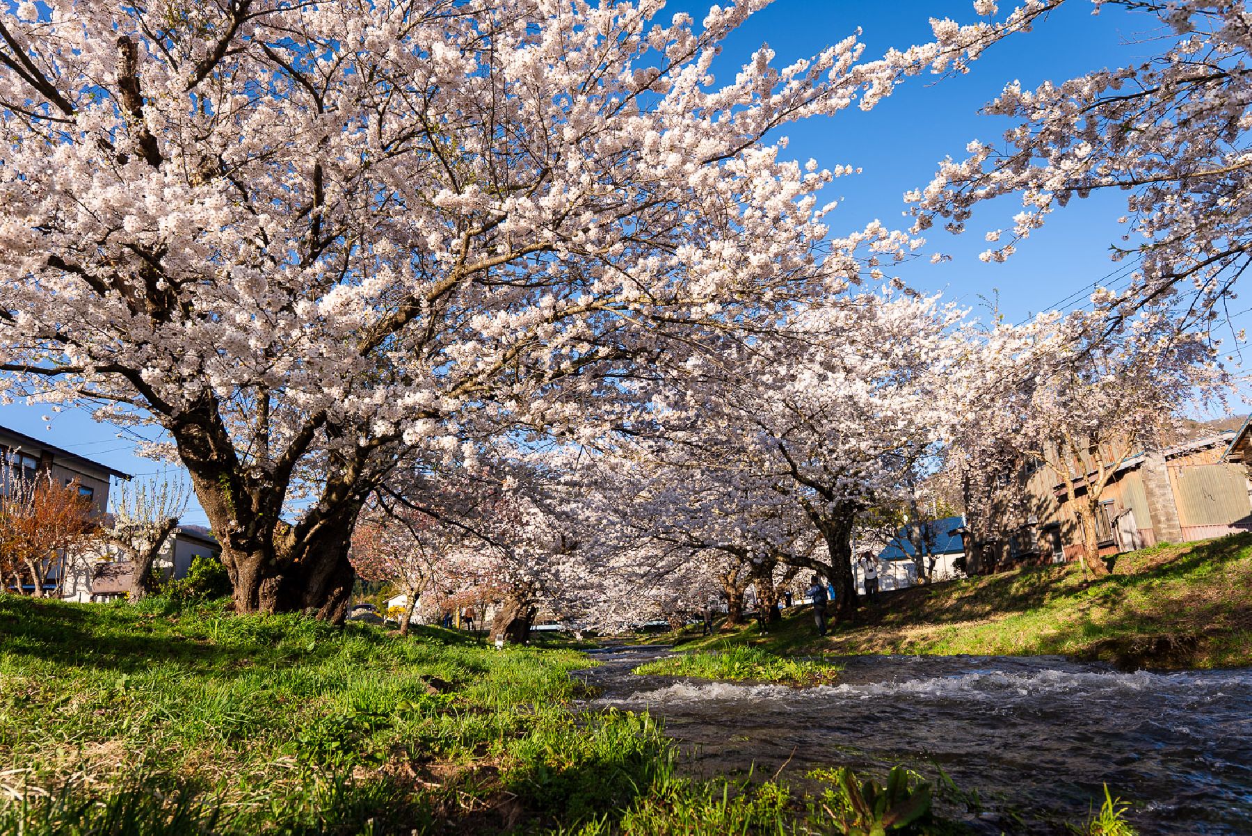
Only a one-minute walk north of Kawageta Station (JR Ban-etsu West Line) is this beautiful 1 km-path along the banks of the Kannonji-gawa River. In the spring the path transforms into a spectacular tunnel of Yoshino cherry trees and weeping cherry trees. Kannonji-gawa River is perhaps the most fantastic place to see cherry blossoms in Fukushima Prefecture; the calming river and the lovely petals falling like snow are a sight that can’t be beat. The lush green bank contrasting with the pale pink blossoms creates an unforgettable scene.

Altogether there are about 200 trees growing along the Kannonji-gawa River on both banks. Additionally, the river maintains its natural curves and bends as it hasn’t undergone any work to adapt its shape to the city surrounding it. It’s one of Fukushima’s most splendid and respected natural landscapes. Currently, the Kannonji-gawa River cherry trees rank number 11 of the best places to see cherry blossoms in the entire Tohoku region!

While enjoying the delicate blossoms and the sweet, fresh air, visitors to Kannonji-gawa River can also enjoy some of the tasty food from street vendors available only during the cherry blossom season. We’d really recommend a springtime picnic right on the river bank with various yatai (food stand) delicacies. Be sure to come back during the evening when the trees are illuminated, and the river transforms into a magical dreamscape.

Venue Details

Venue Details
Websitehttps://bandaisan.or.jp/ib/en/
Contact

Inawashiro Tourism Association

(+81) 242-62-2048

Best Season
  • Spring
Entrance FeeFree
Related infoBest time to see cherry blossoms: Late April
Access Details
AccessAlong the Kannonji-gawa River, Kawageta, Inawashiro Town, Yama District, Fukushima Pref. 969-2663
View directions
Getting there

By Car: 10 min from Inawashiro Bandaikogen I.C. off the Ban-etsu Expressway

By Train: 3 min walk from Kawageta Station (JR Ban-etsu West Line)

Nearby

The World Glassware Hall
Nature & Scenery

Oze National Park

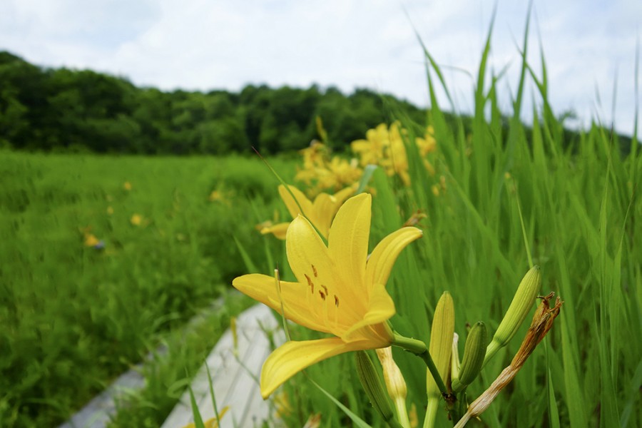
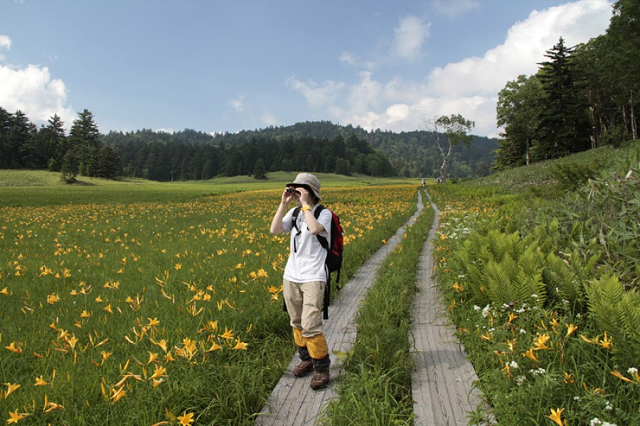
Oze is home to a plethora of beautiful flowers. These include the Asian skunk cabbage that blossoms in the marshes as the snow melts, and the bright yellow of the Nikko Kisuge, which is reflected in the marshes just when the surrounding mountains become green. The nature of Oze is symbolized by its beautiful flowers, and together with the mountains, lakes, marshes, rivers, forests, and wildlife that lives in this region, create a stunning sight. Chozo Hirano opened up the area around 100 years ago, and because of the protection of its magnificent nature up until now, Oze has become a symbol of nature conservation in Japan. The beautiful nature of Oze presents a different face throughout the seasons, and all continue to charm us. Key points of the sightseeing spot/ recommended points for tours:  In order to both preserve the precious nature of Oze, and to be able to come face-to-face with its splendor, we recommend that you visit on weekdays, and take your time to encounter the nature of Oze. Oze has the Ozenuma Visitor Center and the Oze-Yamanohana Visitor Center as locations from which you can both appreciate Oze's nature, and learn about the environment. At the visitor center, you can learn from displays that explain in an easy-to-understand the formation of the nature in Oze, points to see, and the most up-to-date information about the natural environment. This lets you more fully enjoy the appeal of the nature of Oze.Visits are even more enjoyable when you know more; therefore we recommend visits with a guide who can tell you more about the nature and charm of Oze. We urge visitors to make use of the certified guides who have a wealth of knowledge about Oze's nature, culture, and history, and who can ensure your visit is safe.

The World Glassware Hall
Hot Springs

Tokusa Onsen

Tokusa Onsen derives its name from the tokusa (common horsetail plant) which is abundant in the region. It was discovered as a hot spring source approximately 1000 years ago, and has long been known as "Aizu's hidden hot spring". In the public stone outdoor bath, where the hot spring rises directly from the riverbed, you can heal your heart and body while listening to the soft murmuring of the clear stream, which has been unchanged for ages. There are more than 16 ryokan inns and pensions dispersed throughout the Tokusa Onsen region, and it is widely known as the "hamlet of the hidden hot spring". You can take a tip in the stone public bath 24 hours a day, but please be mindful that onsen use is not segregated by gender, nor is it shut off from public view! Not for the faint of heart.

The World Glassware Hall
History & Culture

Former Takizawa Honjin

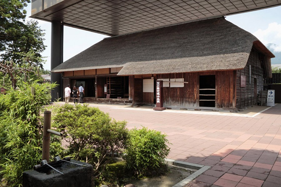
This honjin served as a rest house used by daimyo lords when they traveled to Edo (Tokyo) as part of the Sankin-kōtai system of alternate attendance, or when they conducted inspection tours. During the Boshin War, Domain Lord Matsudaira Katamori took command and the Byakkotai defended their city. The building still has sword marks and bullet holes from the war. The Former Takizawa Honjin is recognized as a nationally-designated Important Cultural Property.

The World Glassware Hall
Gourmet & Shopping

Fruit Land Kita-Aizu

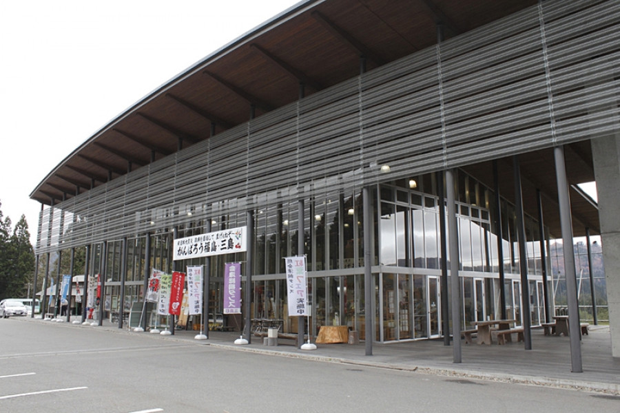
Fruit Land Kita-Aizu is the name of the JA Aizu West Agriculture Center. Fruit Land Kita-Aizu serves as a local hub giving information on a number of nearby orchards in Kita-Aizu Town, Aizu-Wakamatsu City. The orchards that make up Fruit Land Kita-Aizu provide visitors with delicious fruit-picking experiences, which can be tried throughout the year. Please enjoy the delicious fruit that Aizu has to offer, and take in the beauty of its nature at the same time.

You might also like

Goshiki-numa Ponds
Nature & Scenery

Goshiki-numa Ponds

The Goshiki-numa ponds of Urabandai are a cluster of five volcanic lakes at the foot of Mt. Bandai. When Mt. Bandai erupted in 1888, Goshiki-numa - which translates as "Five-Colored Ponds - were formed.In actuality dozens of lakes were created due to the 1888 eruption, but the Goshiki-numa Ponds are the most famous. It was thanks to the eruption that the lakes each took on rich color; the various minerals found in each lake give them a unique color and create a mystical aura.The colors of the Goshiki-numa Ponds also change throughout the year depending on weather and time of day, a truly mysterious phenomenon. The lakes have become a popular tourist destination. The five main lakes are Bishamon, Aka, Ao, Benten, and Midoro, and their colors range from a lime green to deep turquoise to a topaz blue. A scenic walking route guides visitors around the ponds. At 3.6 km in length, this walking route - which will take you past many of the ethereal colors - takes about 70 minutes to complete.If you’d like a view of all five lakes at once, why not take the 4 km walking trail from Bishamon-numa (largest of the five lakes) up to nearby Lake Hibara. Alternatively, if hiking is not on your itinerary, enjoy a simple rowboat out on Bishamon-numa. It’s especially lovely in autumn as the color of the autumn leaves reflects on the deep green surface of the lake. In winter, there are even snowshoe trekking tours offered. The color of the lakes looks particularly vivid in winter, seeing as the minerals in some of the lakes stop them from freezing over, meaning you can see their colors contrasted with the white of the snow.Be sure to stop by the Urabandai Visitor Center, which is a large and well-equipped facility. You can find great information here about tours as well as the various geography, wildlife, and even the history of the area. It’s a great chance to learn more about the ecosystem that makes up the Goshiki-numa Ponds.

Bandaisan Gold Line
Nature & Scenery

Bandaisan Gold Line

The Bandaisan Gold Line road connects Bandai Kogen, a highland rich with lakes diverse in shapes and size, and various alpine plants, and the Aizu area, which has an immensely rich and fascinating history. This submontane sightseeing road offers diverse views of Mt. Bandai (known in Japanese as 'Bandai-san') and can lead visitors to either the mountain's rugged caldera or to the picturesque Lake Inawashiro. Visitors can discover new hidden gems every time they explore the Gold Line by car, making it a very popular spot to return to among tourists and locals. The area surrounding the road is known as a foliage-viewing spot with hairpin curves that carve through the woodlands. On the walking trail that leads to Baya-ike, a "phantom" waterfall, visitors can take in the beauty of the landscape as they hike. The most highly recommended walking course extends from Happodai to the Oguninuma wetlands, where in late June, visitors are greeted by ban array of beautiful, broad dwarf day-lilies.

Mt. Bandai
Nature & Scenery

Mt. Bandai

Originally known as Iwahashi-yama, literally a rock ladder to the sky, the renamed Mt. Bandai is no less impressive. Often referred to as 'Aizu's Mt. Fuji', Mt. Bandai is one of the 100 most famous mountains in Japan, and has even been selected as one of the top 100 geographic landmarks in Japan. In 2011, the mountain was certified as a geopark, which is a unified area with geological heritage and international significance, as defined by UNESCO. There are seven climbing routes for Mt. Bandai, with the trail starting at the Happodai trailhead being the most popular, and easiest route. From the Happodai trailhead, the 3.5 km route takes around 2 hours to reach the summit.The various routes range from 2 to 4 hours and from 3 to 7 km. At Koubou Shimizu, one of the mountain stops, there are two shops where trekkers can buy drinks, snacks, and souvenirs, but please note that there is no accommodation available. For many Buddhist mountain fanatics, Mt. Bandai holds a place of great significance. Enichi-ji Temple, located on the southwestern foot of Mt. Bandai, is a popular temple to visit nearby. The mountains situated around the temple make for a serene vista where one can feel the power of nature. Enichi-ji Temple was founded one year after Mt. Bandai erupted, in 807 C.E.; in the past, some superstitious people believed there was a connection between the eruption and the temple’s founding... Interestingly, Mt. Bandai used to be shaped more like the famous Mt. Fuji, but after a volcanic eruption in 1888, the shape changed to what we see today. It is thanks to that eruption that the mountain gained its rugged, sharp look and the Urabandai area behind Mt. Bandai was created. For non-hikers, the Bandaisan Gold Line is a popular sightseeing road that leads up the southwestern side and offers brilliant vistas of the foliage, especially in autumn when the colors change.

Top