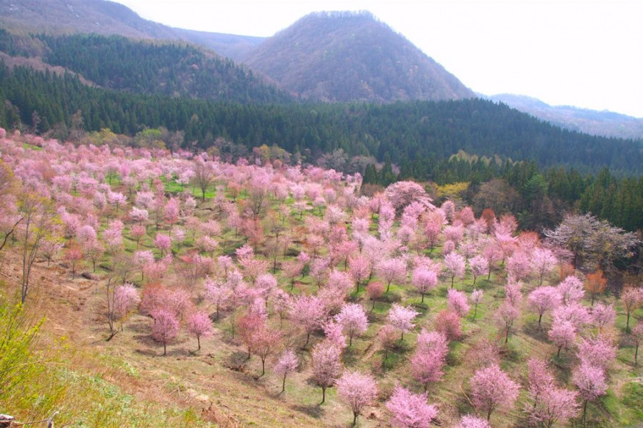
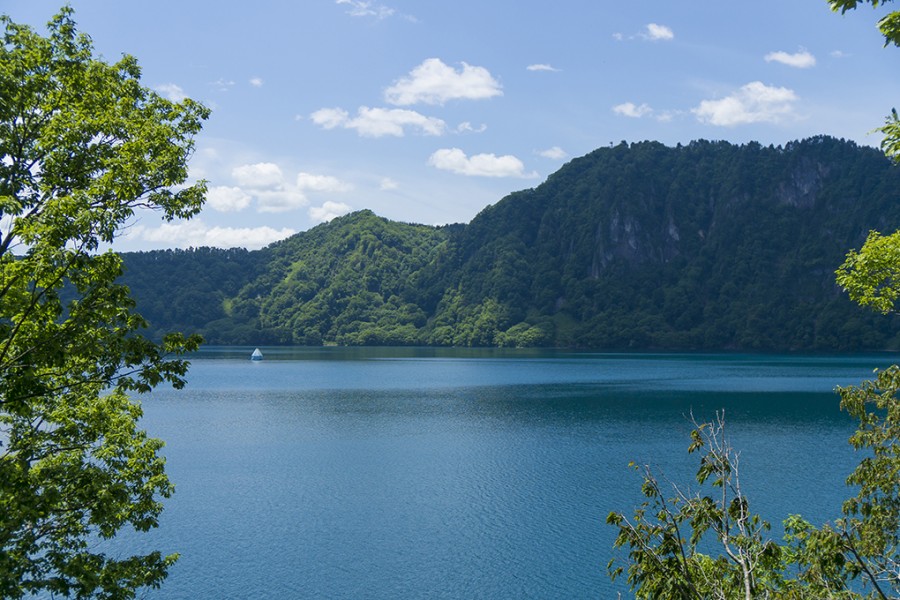
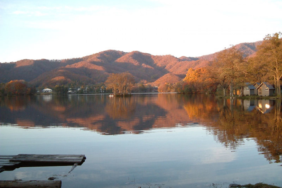
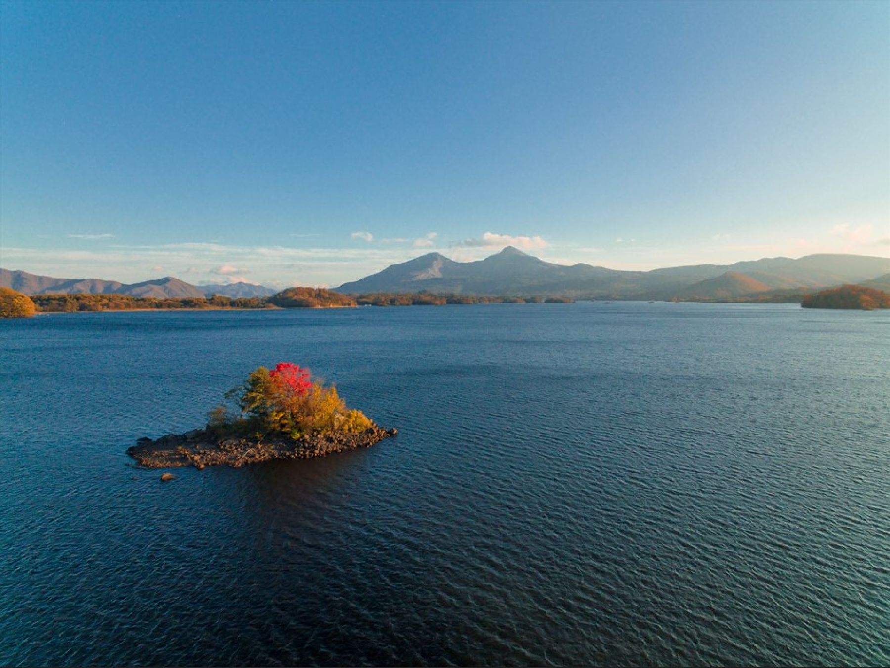
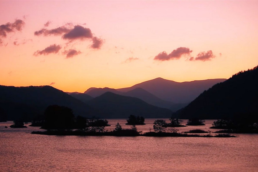
Urabandai Highlands

Urabandai Highlands

The Urabandai highlands of northern Fukushima Prefecture, are situated at an altitude of 800 meters and surrounded by Mt. Bandai, Mt. Adatara, and Mt. Azuma. The highlands were created by Mt. Bandai erupting in 1888. Urabandai is part of Bandai Asahi National Park and offers a variety of seasonal attractions. Cool weather in summer and deep snow in winter make Urabandai a perfect place for both indoor and outdoor enjoyment. About 300 lakes and ponds, including the Goshiki-numa Ponds and Lake Hibara, are scattered across Urabandai. The harmonious beauty of nature created by the abundant woodlands and lakes will certainly touch the hearts of all visitors.

Venue Details

Venue Details
Websitehttps://www.urabandai-inf.com/en/
Contact

Urabandai Tourist Association

(+81) 241-32-2349

staff1@urabandai-inf.com

Best SeasonAll Year
ParkingAvailable
Access Details
Access1093 Kengamine, Hibara, Kitashiobara Village, Fukushima Pref. 969-2701
View directions
Getting there

By Car: 20 min from Inawashiro-Bandaikogen I.C. exit off the Ban-etsu Expressway

Nearby

The World Glassware Hall
Museums & Galleries

Oku-Aizu Hydropower Museum 'Miori'

Oku-Aizu Hydraulic Plaza “Miori” is a free public facility in Kaneyama Town that introduces the role of hydroelectric power in the Oku-Aizu region. It was opened in 2020 and is operated by Tohoku Electric Power Company. The center focuses on how the area’s rivers have been used to generate electricity and support everyday life in the region.Inside, visitors can learn about hydroelectric power through easy-to-understand exhibits that use videos, projection mapping, models, and interactive displays. These explain how electricity is made from water, the structure of dams and power stations, and why renewable energy is important for the future. The displays are designed so that both adults and children can enjoy them.The facility also introduces the history and culture of Oku-Aizu, showing how local communities developed alongside river and power station projects. There are exhibits about daily life in the region, traditional crafts, and the people who supported the area’s development over time, helping visitors understand the connection between energy and local life.The name “Miori” refers to a “water path,” symbolizing the rivers that flow through Oku-Aizu. The building is located next to a roadside station and is within walking distance of the nearest train station, making it an easy stop for travelers exploring the Tadami Line area.If visiting the Oku-Aizu region, Miori combines well with a visit to the Mishima Town Local Crafts Museum and the Tadami River No.1 Bridge.The museum is also located next to the Kaneyama michi no eki or roadside station, which offers local produce, souvenirs and a restaurant.

The World Glassware Hall
Nature & Scenery

Mt. Bandai

Originally known as Iwahashi-yama, literally a rock ladder to the sky, the renamed Mt. Bandai is no less impressive. Often referred to as 'Aizu's Mt. Fuji', Mt. Bandai is one of the 100 most famous mountains in Japan, and has even been selected as one of the top 100 geographic landmarks in Japan. In 2011, the mountain was certified as a geopark, which is a unified area with geological heritage and international significance, as defined by UNESCO. There are seven climbing routes for Mt. Bandai, with the trail starting at the Happodai trailhead being the most popular, and easiest route. From the Happodai trailhead, the 3.5 km route takes around 2 hours to reach the summit.The various routes range from 2 to 4 hours and from 3 to 7 km. At Koubou Shimizu, one of the mountain stops, there are two shops where trekkers can buy drinks, snacks, and souvenirs, but please note that there is no accommodation available. For many Buddhist mountain fanatics, Mt. Bandai holds a place of great significance. Enichi-ji Temple, located on the southwestern foot of Mt. Bandai, is a popular temple to visit nearby. The mountains situated around the temple make for a serene vista where one can feel the power of nature. Enichi-ji Temple was founded one year after Mt. Bandai erupted, in 807 C.E.; in the past, some superstitious people believed there was a connection between the eruption and the temple’s founding... Interestingly, Mt. Bandai used to be shaped more like the famous Mt. Fuji, but after a volcanic eruption in 1888, the shape changed to what we see today. It is thanks to that eruption that the mountain gained its rugged, sharp look and the Urabandai area behind Mt. Bandai was created. For non-hikers, the Bandaisan Gold Line is a popular sightseeing road that leads up the southwestern side and offers brilliant vistas of the foliage, especially in autumn when the colors change.

The World Glassware Hall
Nature & Scenery

Lake Inawashiro Sightseeing Boat

As the fourth-largest lake in all of Japan, Lake Inawashiro is well-known for its gorgeous blue waters, wildlife sightings and stunning views thanks to its position south of the Bandai mountain range. This sightseeing boat gives visitors a chance to get out on to the lake, where they can enjoy the atmosphere and soak in the sights.Guests can step out on to small sightseeing decks at the front and rear, although it's worth bringing a heavy jacket as the wind chill is quite bracing in winter on the front deck.On the interior, announcements over the tannoy explain more about the history of the area in Japanese, English and Mandarin. The journey takes about 35 minutes.The swan boat leaves every hour between 10am and 4pm, while the turtle boat leaves every half an hour on Saturdays, Sundays and public holidays only. In winter, the turtle boat remains docked and functions as a cafe and waiting area (from December 15th). The winter schedule for the swan boat is also reduced, with departures at 11am, 12pm, 2pm and 3pm.

The World Glassware Hall
Museums & Galleries

Fukushima Prefectural Museum

The Fukushima Prefectural Museum (Fukushima Museum) [福島県立博物館] is in Aizu-Wakamatsu City, about a ten-minute walk (750 m) from Tsurugajo Castle. The museum covers the history of Fukushima prefecture from the primitive age through modern times with exhibitions of historical items, relics, scale models, and replicas of objects of historical significance.Its general exhibition is divided into six parts and explains the history of the area in chronological order. Starting with archaeological findings from the Glacial Age, the formation of the Japanese islands, and the first settlements (all covered in the Primitive Age section), the exhibits show the cultural developments and the evolving way of life through to modern times. The last exhibit, ‘Fukushima and its Nature’, details the prefecture’s ecosystems and how they have been impacted by natural disasters through the years.The museum also has departmental exhibition rooms that focus on Fukushima’s geological features and folk culture.Visitors can ask for an English guidebook at the entrance, which contains explanations of most items on exhibit. Information in English, Chinese, and Korean is displayed on some screen panels at the museum.The museum also houses a tea room, the Prefectural Museum Tea Room ‘Tsukinai’, that serves lunch and a variety of drinks. To the right of the main entrance is a recreational room for children. The room has a tatami area, children’s books, wooden toys, and decorations in traditional Aizu momen (cotton) textiles, which give it a unique, warm feel. Throughout the year, several special events and activities for children are hosted in this space.

You might also like

Kannon-numa Forest Park
Nature & Scenery

Kannon-numa Forest Park

Kannon-numa Forest Park (観音沼森林公園) is a picturesque natural area in the Minamiaizu District of Southern Fukushima Prefecture.A wide variety of vegetation, flowers, and birds can be found at Kannon-numa Forest Park. There are nine walking trails, each offering unique sights. The main trail covers about 1.2 km and goes around the Kannon-numa swamp, which is one of the main highlights of the park. The park becomes transformed in each season, with cherry blossoms in spring and hydrangeas in the summer, and it is particularly popular with visitors during the autumn. The colorful trees reflected on the swamp’s waters make for a lovely sight, making it one of the main autumn attractions in the area. The best time to visit to see the autumn foliage is typically from late October to early November. There is also a shrine, Dake Kannondo, believed to have been built over 1,000 years ago.Located about 35 minutes from Ouchi-juku by car, this park is the perfect place to bask in the natural wonders of Shimogo Town. 

Tenkyokaku
Nature & Scenery

Tenkyokaku

Named by the Crown Prince Yoshihito upon its opening in 1907 as “The Palace of Heaven’s Mirror”, Tenkyokaku is a decadently decorated former villa.Imperial Prince Arisugawa Takehito decided to build Tenkyokaku after being impressed by the beauty of Lake Inawashiro during a visit to the Tohoku District. His family, the Arisugawa-no-miya Family, owned the villa until 1952, when it was granted to Fukushima Prefecture.Tenkyokaku has since been used as a meeting hall and a space for lectures and exhibitions. The former villa, its annex and its front gate have been specified as important cultural properties of Japan.Despite being restored in 1984, the building retains many of its original features, including the impressive chandelier which can be seen below.Despite no longer being able to see Lake Inawashiro from the windows of Tenkyokaku, the luxurious renaissance-style architecture and liberal use of all things gold and glittery means that visitors will by all means feel that its name still rings true.For only 1000 yen, you can dress up in a traditional outfit and take as many photos as you would like in the building!

Mt. Bandai
Nature & Scenery

Mt. Bandai

Originally known as Iwahashi-yama, literally a rock ladder to the sky, the renamed Mt. Bandai is no less impressive. Often referred to as 'Aizu's Mt. Fuji', Mt. Bandai is one of the 100 most famous mountains in Japan, and has even been selected as one of the top 100 geographic landmarks in Japan. In 2011, the mountain was certified as a geopark, which is a unified area with geological heritage and international significance, as defined by UNESCO. There are seven climbing routes for Mt. Bandai, with the trail starting at the Happodai trailhead being the most popular, and easiest route. From the Happodai trailhead, the 3.5 km route takes around 2 hours to reach the summit.The various routes range from 2 to 4 hours and from 3 to 7 km. At Koubou Shimizu, one of the mountain stops, there are two shops where trekkers can buy drinks, snacks, and souvenirs, but please note that there is no accommodation available. For many Buddhist mountain fanatics, Mt. Bandai holds a place of great significance. Enichi-ji Temple, located on the southwestern foot of Mt. Bandai, is a popular temple to visit nearby. The mountains situated around the temple make for a serene vista where one can feel the power of nature. Enichi-ji Temple was founded one year after Mt. Bandai erupted, in 807 C.E.; in the past, some superstitious people believed there was a connection between the eruption and the temple’s founding... Interestingly, Mt. Bandai used to be shaped more like the famous Mt. Fuji, but after a volcanic eruption in 1888, the shape changed to what we see today. It is thanks to that eruption that the mountain gained its rugged, sharp look and the Urabandai area behind Mt. Bandai was created. For non-hikers, the Bandaisan Gold Line is a popular sightseeing road that leads up the southwestern side and offers brilliant vistas of the foliage, especially in autumn when the colors change.

Top